Nature strategy needs a place: Why biodiversity strategy only works when it's anchored not in metrics but in location, history, and ecological systems.

Business case
- Nature risk is systemic, not categorical; deforestation, water, biodiversity, and pollinator decline are not parallel tracks but a single cascade.
- Siloed metrics miss the ecological relationships that determine whether a sourcing region remains productive.
- A systems-oriented nature strategy can start at any level of data availability — country, commodity, region, or site — and becomes more precise as data improves.
The problem with adding nature to the list
Corporate sustainability has always been good at adding things. First came carbon accounting. Then water stewardship. Then human rights due diligence. Now nature and biodiversity. Each new topic arrives with its own framework, its own metrics, and gets added to the growing list of things a sustainability team must track, disclose, and manage.
This additive logic made sense administratively. It doesn't make sense ecologically.
Nature doesn't operate in categories. A cocoa farm in Côte d'Ivoire isn't experiencing deforestation pressure, water stress, pollinator decline, and soil degradation as four separate problems sitting in four separate columns of a spreadsheet. It's experiencing one systemic condition, expressed through multiple measurable signals. And that condition is place-specific, historically contingent, and ecologically interconnected.
When we treat biodiversity as another category to report on, we import the same siloed logic that has limited the effectiveness of climate action for decades. We measure what's easy to measure, aggregate it into scores, and call it a strategy. But a score is not a strategy. A score tells you that something happened. A strategy requires knowing where, why, and what is likely to happen next.
Every material is born from a landscape. Every landscape tells a story. Nature strategy needs to learn how to read it.
What it means for a system to be somewhere
When ecologists talk about a place, they mean something richer and more demanding than a GPS point or a sourcing country. A system that is somewhere has multiple properties that no metric can fully capture, but that any serious nature strategy must account for.
The closer you look at a landscape, the more it reveals. A region tells you what kind of ecosystem you're dealing with. A site tells you what's actually happening there. And the organism pollinating the crop — the midge, the moth, the beetle — tells you whether the relationships that hold the whole system together are still intact.
It has coordinates.
This sounds obvious; it isn't. Most corporate nature assessments operate at the country level, the commodity level, or the regional level. Not at the site level. A sustainability report that states "we source cocoa from West Africa and are committed to zero deforestation" tells you almost nothing about what is actually happening in the landscapes where that cocoa grows. Two cocoa farms separated by ten kilometres can have entirely different ecological risk profiles: one sitting within a stable landscape, one embedded in a deforestation front advancing from the edges.
Site-level analysis is not a technical nicety. It is the minimum unit at which nature risk becomes real. A doctor diagnosing a patient based on national health statistics is not diagnosing the patient. A procurement team assessing supplier risk based on country-level biodiversity indices is not assessing the supplier.
But many companies still don't have polygon-level location data for their suppliers. Many know only the country of origin, or the commodity and region. That is not a reason to wait.
A systems-oriented approach can enter at any level of the data chain: with a specific polygon if supplier location data exists, with a sourcing region if it doesn't, with a commodity and country of origin if that is all that is available.
The point is not that precision is a prerequisite. It is that at every level of specificity, a systems lens asks different and better questions than a siloed metric does. A company that knows only that it sources cocoa from West Africa can already ask: which functional ecological relationships does cocoa depend on in this region? What does the forty-year water history of that landscape look like? What deforestation pressure is documented in the primary producing areas? Those are systems questions, not compliance checkboxes, and they lead to different sourcing conversations. As supplier data improves, as polygon-level location data becomes available, as due diligence requirements push traceability deeper into supply chains, the analysis becomes more precise. But the thinking can start now, at whatever resolution the data supports.
It has a past.
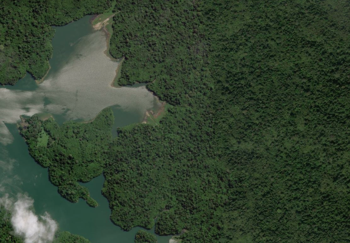
Landscapes have histories. The European Commission's Joint Research Centre has mapped surface water globally at 30-metre resolution for every year from 1984 to 2021. That dataset does not just tell you where water is today. It tells you what has been happening to a landscape for four decades. Which water bodies have persisted, which have become seasonal, which have disappeared entirely.
A sourcing region where permanent water bodies have been steadily converting to seasonal and then lost over forty years is not a stable environment, regardless of what the current satellite image shows. That trajectory tells you something about upstream deforestation, changing land use, soil compaction, the loss of water-retaining vegetation. It tells you whether the ecological conditions that made this region productive are being maintained or eroded.
History is a vital data point. A system without a past is a system you don't understand.
It has a bioregional context.
Every location on Earth sits within an ecoregion, a zone defined by its characteristic climate, soils, vegetation, and species assemblages. The Madeira-Tapajós moist forests of the Brazilian Amazon have a different ecological baseline than the degraded agricultural landscapes that increasingly surround them. Knowing which ecoregion a sourcing site sits within tells you what should be there; what functional groups of species, what ecological processes, what levels of biodiversity.
This matters because absence is as informative as presence. When a sourcing region shows sparse records for animals and plants, that absence may reflect genuine ecological impoverishment – functional groups missing from a landscape that needs them. Or it may reflect data gaps in regions that have been less systematically surveyed. Knowing the bioregional baseline helps distinguish between the two.
A nature strategy that doesn't know what should be present at its sourcing sites cannot meaningfully assess it.
It has neighbors.
A site does not exist in isolation. What is happening in the surrounding landscape determines what will happen at the site, often before any changes become visible within the site boundaries themselves.
Our near-real-time deforestation monitoring systems detect alerts not just within agricultural boundaries but in the buffers surrounding them. A sourcing site with two deforestation alerts within its boundary and forty-two alerts in the surrounding two-kilometre zone is telling you something important: the site itself is currently intact, but the landscape it depends on is under active pressure. That distinction — between a site that is isolated and stable, and a site that is intact but surrounded by a degrading landscape — is invisible at the country or commodity level. It only becomes visible when you look at the place and its neighbors together.
Deforestation advancing from the edges is a different risk signal than deforestation concentrated elsewhere in the region. Buffer zone analysis is not a technical detail. It is the difference between "this supplier is fine" and "this supplier is fine today."
It has relationships.
This is the dimension that most completely escapes metric-based approaches, and the one with the most direct consequences for supply chain resilience.
Ecological systems are held together by relationships. Species depend on other species. Crops depend on pollinators. Pollinators depend on habitat. Habitat depends on whether the surrounding landscape has been converted. Break any link in that chain and the production system becomes fragile, often long before yield data or supplier audits show anything has changed.
Consider cocoa. West Africa produces over 70% of the global supply, in regions that are simultaneously among the most biodiverse and most threatened ecosystems on Earth. Cocoa is pollinated not by honeybees but by specialized midges — Forcipomyia species — that require the shaded, humid microhabitats of intact forest to survive and reproduce. The same deforestation that drives cocoa expansion destroys the habitat of the organism that makes cocoa production possible. The crop is actively undermining its own ecological infrastructure.
This is not an isolated case. Palm oil is pollinated by weevils and flies that depend on diverse vegetation the monocultures replace. Conventional cotton farming deploys some of the highest pesticide loads in global agriculture: loads that devastate pollinator populations not for cotton's own sake, since cotton is largely self-pollinating, but for the crops and ecosystems that share those landscapes and do depend on pollinators to survive. Natural rubber monocultures eliminate the surrounding biodiversity that serves as a natural buffer against the fungal diseases that could collapse global rubber supply.
In each case, the production system is in tension with the ecological relationships it depends on, and that tension is invisible to any metric that treats deforestation, biodiversity, and input intensity as separate categories rather than dimensions of a single systemic condition.
The Cambridge Conservation Initiative identified this gap as far back as 2018: companies sourcing pollinator-dependent crops largely don't know which of their raw materials depend on pollinators, let alone whether the ecological conditions that support those pollinators are intact at their sourcing sites. Seven years later, that gap remains largely unfilled. (We are actively trying to fill that gap!)
What a systems-oriented nature strategy actually looks like
If the problem with current approaches is that they are additive and placeless, the solution is integrative and place-based. That is easier to say than to implement. But the direction is clear.
It reads dimensions together rather than separately. Deforestation pressure in the surrounding landscape is more alarming when combined with declining vegetation vitality trends over four years and sparse pollinator functional group records. Water body loss over forty years is more significant when the affected region produces a high-pollinator-dependence crop in a biodiversity hotspot. The interaction between dimensions is where the real signal lives; and it only becomes visible when those dimensions are analyzed together, in a specific place, with its specific history.
It distinguishes between what is and what has been happening. A snapshot of current conditions is useful. A trajectory of the landscape goes deeper.
A systems-oriented nature strategy connects ecological conditions to production risk in language that reaches beyond the sustainability team. The cocoa buyer who understands that their supplier's intact fields are surrounded by a landscape under accelerating deforestation pressure — and that the midges those fields depend on are losing habitat in that surrounding landscape — has a different conversation with their procurement director than one armed with a country-level biodiversity score.
A systems-oriented nature strategy starts wherever the data is. A commodity-level systems analysis is better than a commodity-level metric. A regional systems analysis is better than a regional score. A site-level analysis is better still.
The goal is not to wait for perfect data before thinking systemically. It is to bring systems thinking to whatever data exists, and to build toward greater precision as data improves.
From reporting to strategy
The regulatory frameworks — CSRD E4, TNFD LEAP, EUDR, ESPR — are pushing companies toward nature disclosure. That is necessary and overdue. But disclosure is not strategy.
Reporting what you have measured is not the same as understanding what is at stake.
The shift from nature reporting to nature strategy requires exactly the move described here: from categories to systems, from scores to places, from snapshots to histories, from isolated metrics to interconnected relationships.
A sustainability manager who knows that their sourcing region has lost 40% of its permanent water bodies since 1984, that the surrounding landscape shows forty-two high-confidence deforestation alerts in the last ninety days, that the crop they source is essential for pollinator dependence, and that the functional groups those pollinators belong to are showing reduced records in the area — that manager has something a dashboard score cannot give them: a diagnosis. And a diagnosis is the beginning of a strategy.
Every material is born from a landscape. Every landscape tells a story. The question is whether your nature strategy is learning to read it.
Archaster Labs develops nature intelligence software for procurement, sustainability, and design/materials teams.
Location-specific environmental analysis — combining satellite imagery, deforestation monitoring, biodiversity indicators, and surface water analysis with AI-powered interpretation — for any sourcing location. No GIS expertise needed.
www.archasterlabs.earth